![]()
![]()
Besse-et-Saint-Anastaise
 CHIEN INTERDIT
Distance : 58.4 km
Durée : 3h
Difficulté : Difficile
Tracé : Boucle
Dénivelé : 724 m
dsio.detail.telecharger
dsio.detail.topo
Étape 1 : Warm-up from Besse (km 0 to 7).Start in Besse (repair kit available from the Tourist Office). The first few kilometers take you out of the medieval town and gently up to the plateaux. Be careful at km 7.7, as the crossroads is marked as dangerous.
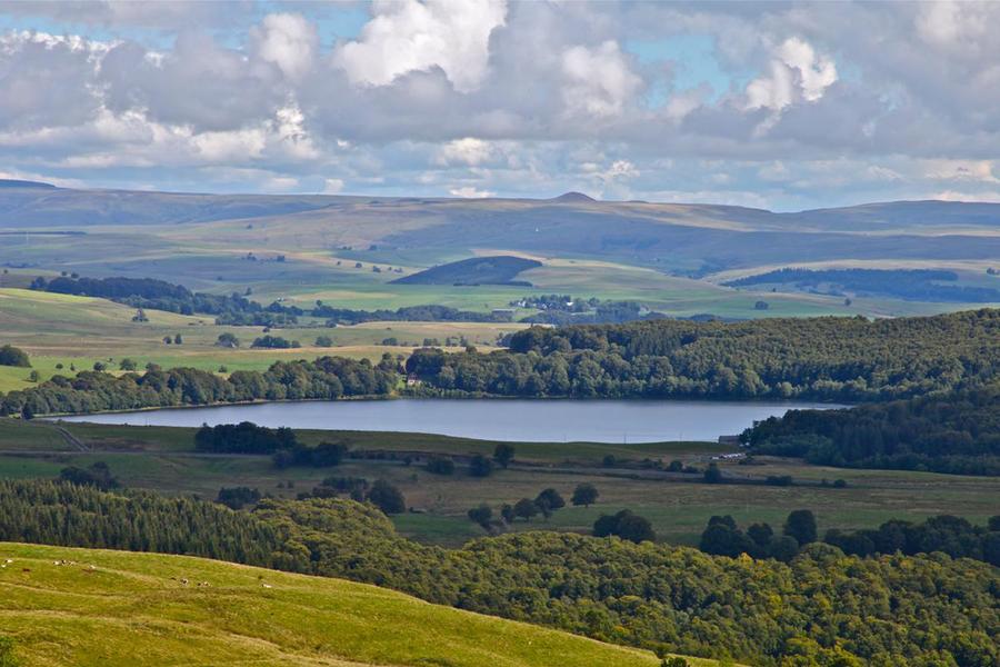
Étape 2 : Crossing high plateaus and lakes (km 8 to 40).This long section is the heart of the route. It takes you along ridge and plateau roads through three distinct zones:- Lac Pavin: An almost perfectly circular, very deep crater lake (maar).- Lac Chauvet: Also a volcanic maar, surrounded by forests.- Lac de Bourdouze: A remarkable wetland, a remnant of the Ice Age, rich in protected flora.The route is a succession of climbs and descents (“bumps”) typical of the Espace Cyclosport du Sancy.
Étape 3 : Logistics break at Picherande (km 40).At km 40.7, you pass close to the Picherande town hall.Service: The “Maison des Randonneurs” offers a drinking water point and toilets, ideal for refueling before the last section.
Étape 4 : Return to Besse (km 41 to 58).The end of the route marks the start of the return journey eastwards. You cross vast stretches of mountain pasture grazed by Salers or Aubrac cows. The profile remains undulating until the final traffic circle, which takes you back to the parking lot at the Besse multi-purpose hall.
dsio.detail.topo
Opening
From 01/04 to 31/10/2026.
dsio.detail.titles.equipements
dsio.detail.complement
Lakeside or by stretch of water, Waterside, Mountain view
dsio.detail.maj19 February 2026