![]()
![]()
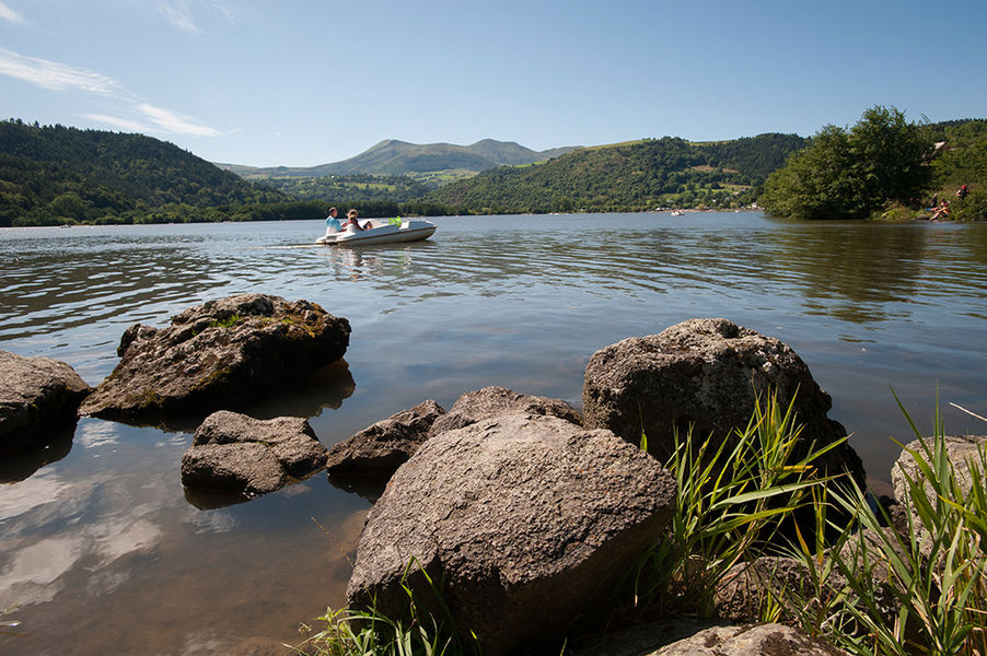
Chambon-sur-Lac
Pédestre
Distance : 11.5 km
Durée : 4h15
Difficulté : Difficile
Tracé : Boucle
Dénivelé : 445 m
Balisage : Green
dsio.detail.telecharger
dsio.detail.accesPoint
From Murol, south-west of Clermont-Ferrand, take the D996 towards Le Mont-Dore. Pass Lac Chambon, then turn left into the village of Chambon-sur-Lac. Parking lot at Place de la Fontaine.
dsio.detail.topo
Étape 1 : From the start sign, take the one-way street, turn right into chemin des Ponts, join a road, follow it to the right for 20 m and turn left into chemin des Chirbes. Join a road, cross it and go straight up. Turn right onto a path leading to “Pré Soubre” (view of Lac Chambon, the Chaudefour valley and the Sancy massif). Continue until you reach a fence at the end of the path.
Étape 2 : Cross the fence and climb left along the edge of the meadow. After passing a stepladder, turn right. Join a road (stepladder) and follow it to the left. At the junction with the D996, turn left towards Bressouleille. In the village, turn right at the 2nd fork in the road.
Étape 3 : Go up to the right (water trough, cross, communal oven) and continue along this street, keeping to the right until you leave the village. Continue along a track, cross a stream on a footbridge, climb back up and pass a house. Go as far as the crossroads and take the grassy path on the right. At the fork, keep right, then at the next crossroads turn left onto the track leading to Surains. Ignore the left and right paths and follow the houses to a crossroads.
Étape 4 : Go downhill to the left, then turn right at the first crossroads and continue straight downhill (view of the Livradois mountains and Murol castle). After a steep descent, cross a stream (waterfalls). The path continues down through the woods, crosses the couze de Surains and climbs back up. Stay on this wide track until it joins a road.
Étape 5 : Take a wide track opposite which leads to a hamlet. Cross the road and descend into the hamlet. Continue downhill on this track, leaving two paths to the left, continue on the narrow road and cross the stream. Follow the stream to reach the starting point.This trail is proposed and managed by the Conseil départemental du Puy-de-Dôme – PDIPR.
dsio.detail.topo
Opening
From 01/01 to 31/12 daily.
Subject to favorable weather.
dsio.detail.titles.equipements
dsio.detail.complement
Mountain location, Presence of livestock and guard dogs
For your own safety, always take a bottle of water, a hat, warm clothing and footwear suitable for walking.
Depending on weather conditions, certain itineraries are not recommended in bad weather (fog) or are not practicable, or even forbidden, during the winter season.
Some sites are fragile, so stay on the marked trails. Avoid picking wild flowers and disturbing wildlife. Pick up your garbage.
Animals are not allowed on some routes.
dsio.detail.animaux
Dogs must be kept on a leash due to the presence of herds.
dsio.detail.maj11 June 2026