![]()
![]()
Égliseneuve-d’Entraigues
Pédestre
 CHIEN INTERDIT
Distance : 135 km
Durée : 8jours
Difficulté : Modéré
Tracé : Boucle
Dénivelé : 3950 m
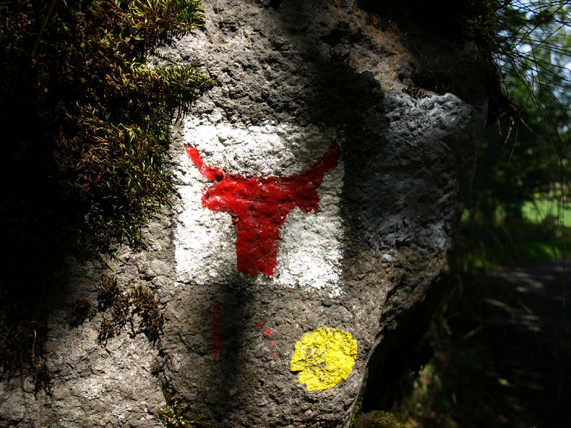
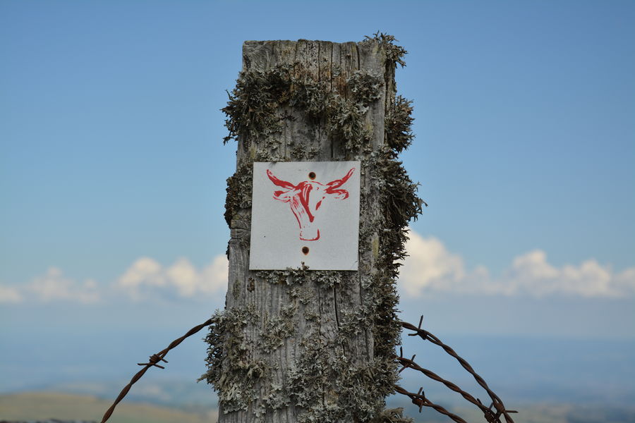
Balisage : Red Cow
dsio.detail.telecharger
dsio.detail.accesPoint
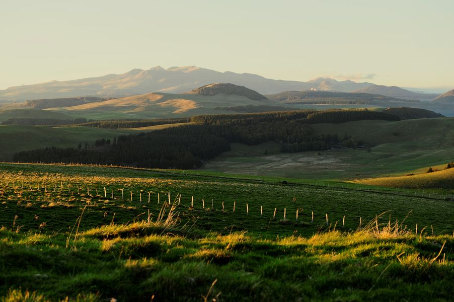
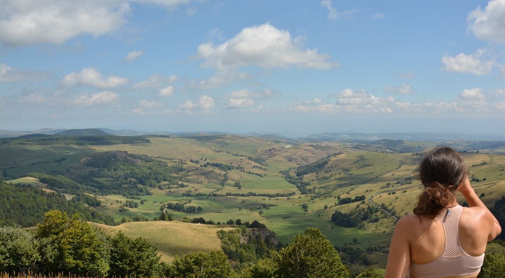
Égliseneuve-d’Entraigues is 65 km southwest of Clermont-Ferrand.
dsio.detail.topo
Étape 1 : Turn right onto the Chemin de la Roche Marchal and continue straight on to the hamlet of Bac (1.2 km). You’ll pass the Arboretum, a theme park with picnic tables and benches.
Étape 2 : Turn right in front of the baker’s oven, continue to the D 679. Pedestrian bridge – Bread oven – Cross and Virgin and Child in wall niche.
Étape 3 : Cross the RD 679 and go straight ahead, then after 50 m, take the track on the left (small stream below). Continue between meadows for approx. 750 m.
Étape 4 : At the fork in the road, turn left and then left again at the entrance to the Fouet-Haut woods. Cross it and, after the climb, return to a ridge. Continue straight ahead, then descend towards the hamlet of Piquemeule.
Étape 5 : Go past the Piquemeule barn (remarkable for its size) and take the large track on the right; cross the Allanche stream.
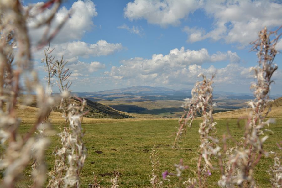
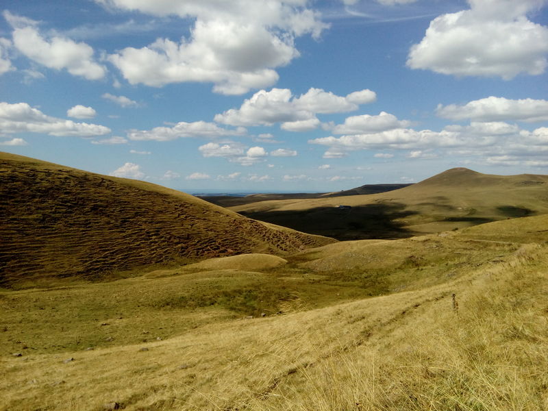
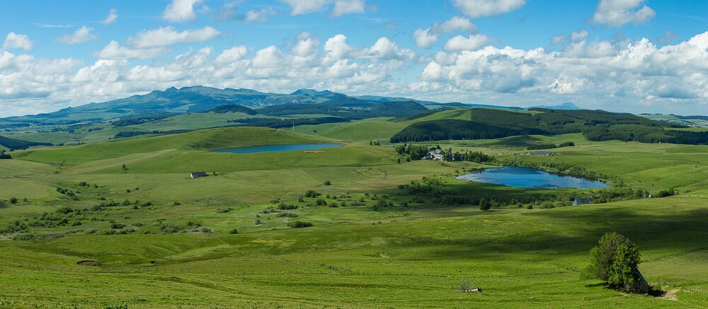
Étape 6 : At the fork, take the left-hand path upwards (views of the Monts du Cantal and the south-western slopes of the Cézallier).
Étape 7 : At the crossroads, keep right and return to the road (RD 39).
Étape 8 : Turn left as far as Pradiers (information panel – picnic table – church).
Étape 9 : From Pradiers church square, go down the small staircase, past the EDF transformer and down the street leading to the north end of the village; fork left, then right towards the last houses.
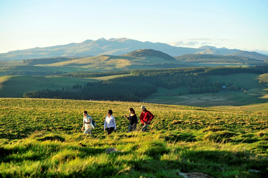
Étape 10 : Take this old track which veers off to the right, then cross 2 successive rus in 2 90° left-hand bends. Go up a track halfway up the slope lined with tall trees (view of the Monts du Cantal); continue due north (through 4 gates) to the hamlet of Courbières.Cross an old stone bridge, and after a short climb to the left, reach the top of the hamlet. Turn right and continue uphill to a fork in the road.
Étape 11 : Turn left; pass a water tank, ignore a path to the right, and at the next fork turn right.
Étape 12 : At the edge of the wood, go through a gate; follow the plantation and continue straight ahead in the meadow for 200 m to a gate. Go through the gate and continue along the fence to a nearby 2nd gate. Follow the fence in the same direction to reach an old, perpendicular sunken track.
Étape 13 : Go up to the right for about 200 m, then at the fork in the road, turn left onto a good track leading to the meadow. Follow it to Rascoupet.
Étape 14 : At the hamlet, go straight on for 50 m. Turn left at the gable end of a large building, as far as Rascoupet-Bas. At the crossroads, turn left onto the small road for about 150 m to leave the hamlet.
Étape 15 : Turn right and follow the south-facing track along fields and meadows, keeping to the fence.
Étape 16 : Turn right (left, ferme des Prades – Lodging). At the end of the track, cross a small road (on the left, you can visit the La Roche basaltic flow site (classified as a sensitive natural area) in 20 min AR) and climb the track opposite to reach a road.
Étape 17 : Turn right and follow the road for about 850 m. At the crossroads, turn left at the farm and climb up to the hamlet of Greil. Follow a tarmac lane between 2 houses (fire hydrant) and continue up to a crow’s-foot. Go straight on, and stay on this track until you reach a fence.
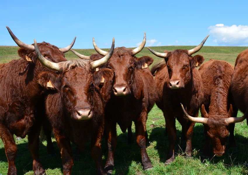
Étape 18 : Go through the fence and follow the track which heads level towards the buron de Marquisat (private property; cows grazing). When you reach the buron, cross an electric fence and follow the faint, level track heading north-west (a small stream runs parallel to and to the right of the track marked with large stones). Head straight for a partially buried reservoir on the other side of a fence. Follow the fence upwards, without crossing it, for over 100 m to reach a gate.
Étape 19 : Cross 2 successive fences (gates) and descend towards the Marquisat farm. Follow the road opposite.
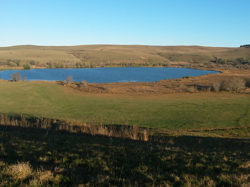
Étape 20 : Just after reaching La Clède farm (crossroads), take the left-hand path. Pass a reservoir (bench) and descend towards the INRA facilities at La Borie.
Étape 21 : After the farm buildings, turn right onto a good track lined with tall trees. Follow it to Marcenat.Stage 7 – Marcenat – MontgreleixDistance: 14.8 kmTime: 4 h 15Altitudes: 1,049 m / 1,273 mCumulative elevation gain: 555 mDeparture point: Parking place de Castellane, MarcenatStart – From Marcenat’s main street, descendProposed and managed by the Conseil départemental du Puy-de-Dôme – PDIPR.
dsio.detail.topo
Opening
Open from May to October.
dsio.detail.complement
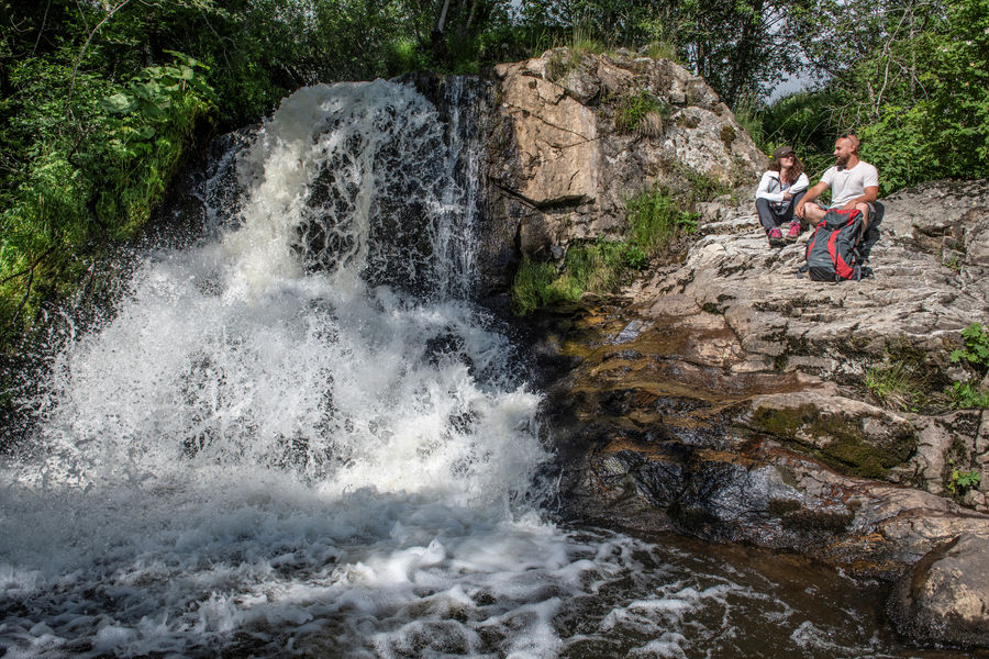
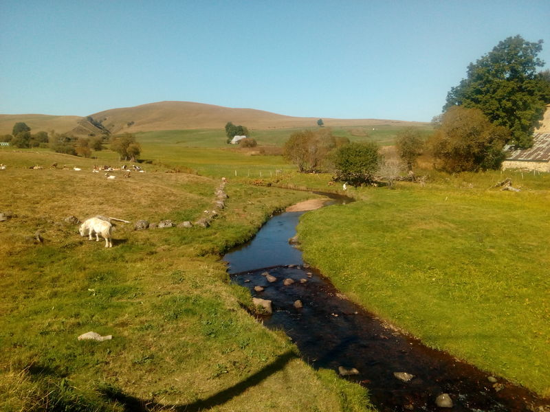
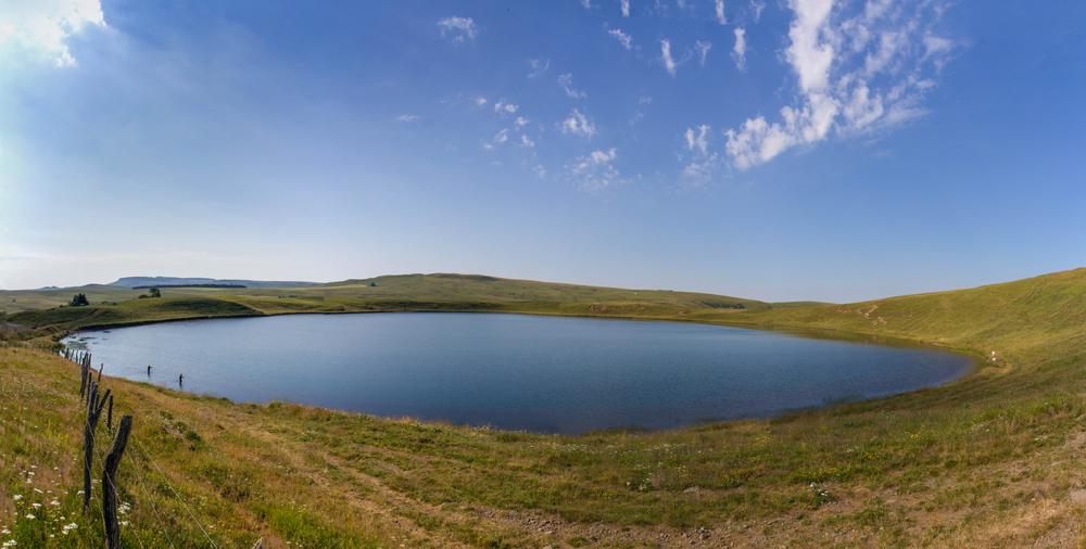
Lakeside or by stretch of water, Mountain view, Mountain location, Village -2 km away, Waterside, Pond within 5 km, In a nature reserve, Presence of livestock and guard dogs
For your own safety, always take a bottle of water, a hat, warm clothing and footwear suitable for walking.
Depending on weather conditions, certain itineraries are not recommended in bad weather (fog) or are not practicable, or even forbidden, during the winter season.
Bivouacs: during summer time, tents must be pitched after 8 p.m. and dismantled by 8 a.m. The bivouac site must be located at the edge of the forest, excluding the slopes, craters and summits of volcanoes, unless otherwise indicated on the site. The agreement of the landowner must be sought.
Open-air fires are permitted in specially designated areas. Otherwise, all fires are prohibited within 200 m of the edge of a wood or forest, or under the terms of a prefectoral decree.
The use of portable gas stoves is nevertheless tolerated, in a setting that is as safe as possible (stable, away from flammable materials, etc.).
Stay on marked trails. Respect private property.
Bring your own rubbish bags for picnics, snacks and other waste, and use the containers available at most parking lots.
Do not disturb wildlife.
Don’t pick flowers, as many are protected (even those that seem very ordinary or common).
dsio.detail.maj29 May 2026