![]()
![]()
Mont-Dore
Pédestre
 CHIEN INTERDIT
Distance : 18 km
Durée : 7h
Difficulté : Difficile
Tracé : Boucle
Dénivelé : 1050 m
Balisage : Green
dsio.detail.telecharger
dsio.detail.accesPoint
Le Mont-Dore, 44 km south-west of Clermont-Ferrand. Parking and departure sign near the tourist office on avenue de la Libération.
dsio.detail.topo
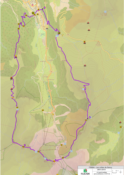
Étape 1 : From the start sign, walk down Avenue de la Libération for 80 m, then turn right onto Chemin des Mille Gouttes. Continue uphill, ignoring the side paths, to the funicular station. Follow the road up to the salon du Capucin.
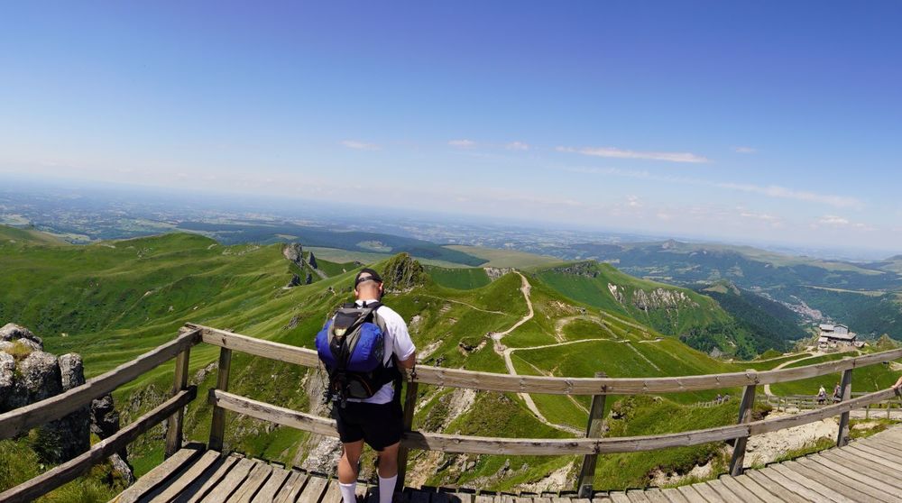
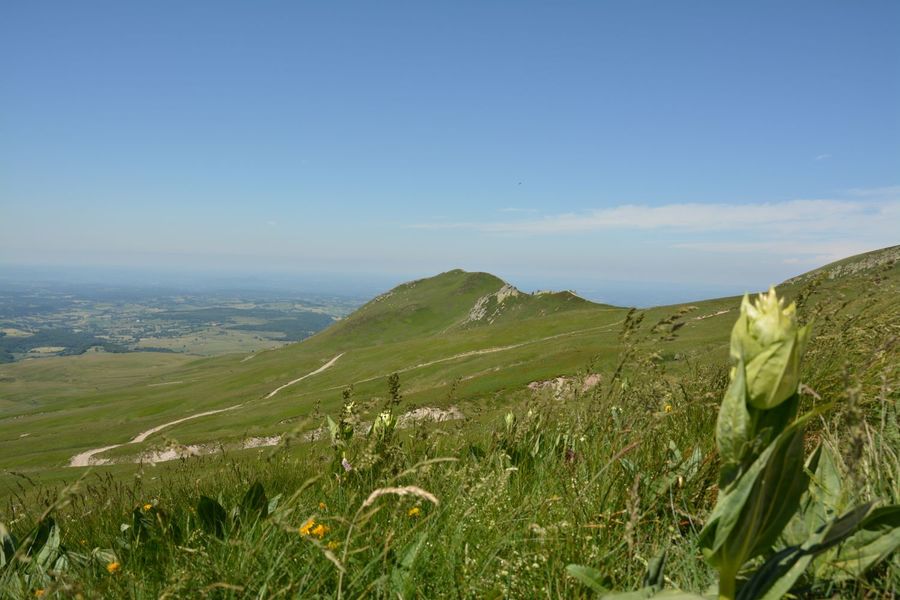
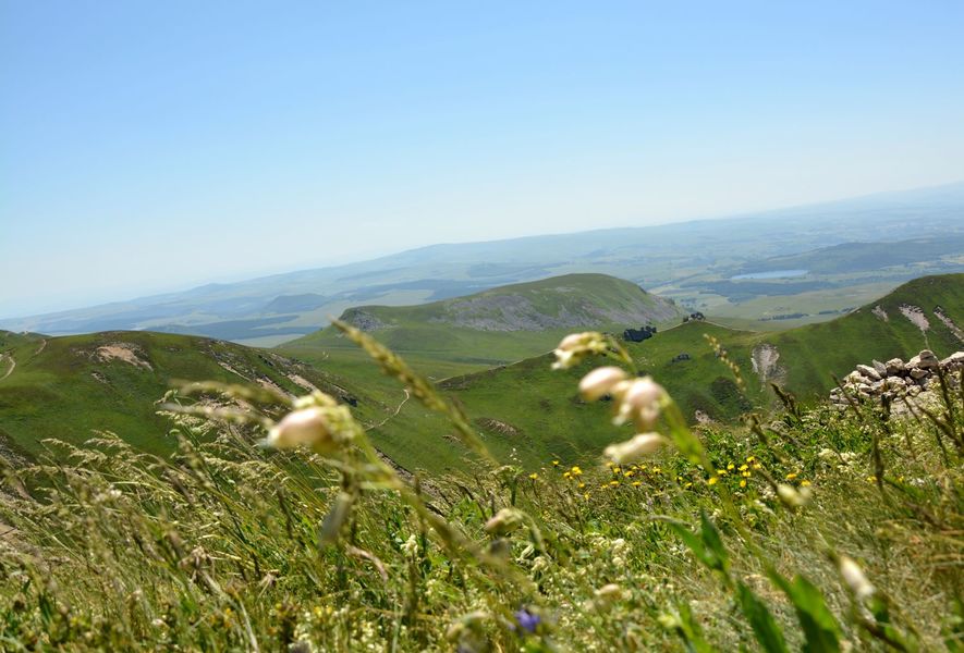
Étape 2 : At the restaurant, turn left onto the road leading up to the buron du Capucin. Cross the fence (the summit of Le Capucin is off the circuit, at 200 m) and follow the wide path leading to an old quarry. After the quarry, turn left and climb up (Chastreix Sancy nature reserve) to the puy de Cliergue (view of the Sancy, the Mont-Dore glacial valley, the Chaine des Puys, the Guéry plateau, the Banne d’Ordanche, the Chastreix plateau, the Combrailles). Continue to the Tour Carrée (view of the Fontaine Salée valley, Lac Chauvet, Monts du Cantal), then to the Col de Courre.
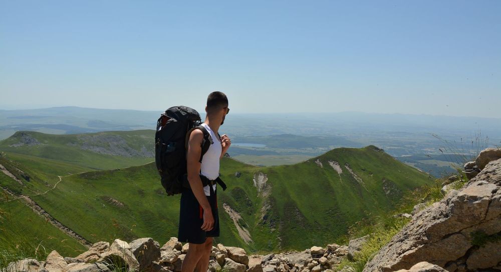
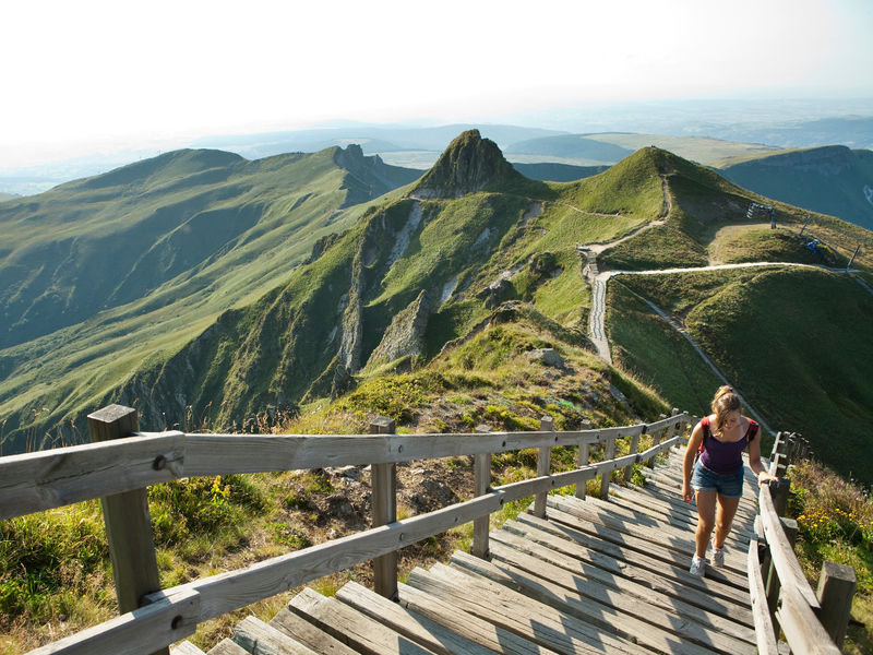
Étape 3 : Continue uphill, crossing the Pas de l’Âne to reach the Pas de l’Âne platform (information panel). Take the stairs to the summit of the Puy de Sancy (360° view, orientation table). Descend on the opposite side to the Col de la Cabane.
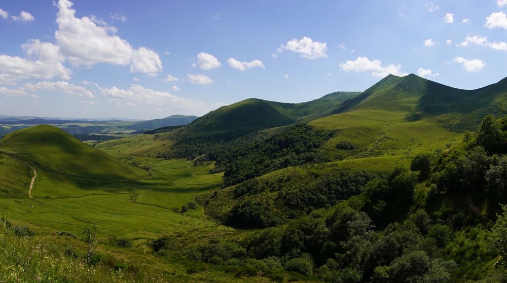
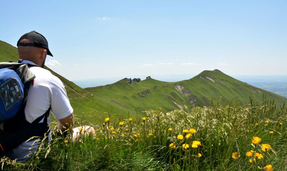
Étape 4 : Turn left down a wide path leading to Pan de la Grange. Turn right onto a balcony overlooking the Chaudefour valley (view of Dent de la Rancune, Crête de Coq, Lac Chambon, Murol castle), then skirt the summit of puy de Cacadogne. Climb the puy des Crebasses to a crow’s foot (view of the Cézallier plateau) on a small flat area.
Étape 5 : Descend to the left and reach the summit of the Roc de Cuzeau. Descend to a fence. Don’t cross it, but turn left, walk along it for 250 m, cross it and continue to the Grande Cascade. Access the base of the waterfall via stairs and a footbridge. Continue downhill on a good path to a road, cross it and follow the path for 800 m until you come to a first path on the left below.
Étape 6 : Take it. At Le Mont-Dore, continue straight ahead along Rue Perpère. Cross the park to reach the start.Proposed and managed by the Conseil départemental du Puy-de-Dôme – PDIPR.
dsio.detail.topo
Opening
From 01/05 to 31/10 daily.
Closed in winter as the ridges become impassable.
Subject to favorable weather.
dsio.detail.complement
Forest location, Mountain view, Mountain location, Presence of livestock and guard dogs
For your own safety, always take a bottle of water, a hat, warm clothing and footwear suitable for walking.
Depending on weather conditions, certain itineraries are not recommended in bad weather (fog) or are not practicable, or even forbidden, during the winter season.
Some sites are fragile, so stay on the marked trails. Avoid picking wild flowers and disturbing wildlife. Pick up your garbage.
Animals are not allowed on some routes. From 30/05 to 31/10/2026: Presence of a flock of ewes guarded by 2 protection bitches in the Col de la Croix Saint-Robert sector (west crest of the Chaudefour valley, Cacadogne, Puy des Crebasses, Roc de Cuzeau, Plateau de Durbise, Grande Cascade).
dsio.detail.maj1 June 2026
dsio.detail.titles.objetLien