![]()
![]()

Crédits photo bandeau The Crêtes du Sancy from Puy de la Tache
The GR®4 long-distance hiking trail crosses the Massif du Sancy from North to South, visiting some of the key sites of Sancy such as Col de la Croix Morand, Col de la Croix Saint Robert, the Puy de Sancy summit, the resort of Super Besse and Chauvet lake.
2 days and 2 different settings for this long-distance hike in Auvergne:
Col de la Croix Morand - Super Besse: 16km, 762m elevation gain
A steep, mountainous section on the rolling terrain of the Sancy summits, from Puy de la Tache to Puy de Sancy, before making the descent to Super Besse.
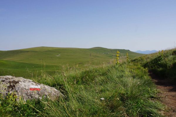
Super-Besse - Egliseneuve d'Entraigues: 15km, 42m elevation gain
A gentle day’s hiking on mountain plateaus and along the banks of the Hermines and Chauvet lakes.
It’s up to you to decide in which order you’ll climb them...

View of Lake Chauvet and the Monts du Cantal

GR 4 stage at Lac Chauvet

View of Lake Chauvet and the Monts du Cantal
Practical tip: for greater peace of mind, take a map and guidebook with you.
The GR®4 “topoguide” is a hiking guide published by the French Hiking Federation. You’ll find it online or at bookshops under the title:
Volcans et Lacs d'Auvergne - GR®441 - GR®4 - GR®30
The ideal map to take on the GR®4 trail is the Chaîne des Puys & Massif du Sancy Top 75 IGN map. This is available in bookshops and at the Sancy Tourist Offices. The Massif du Sancy Chamina map is also a good choice.
Tips
Be smart! On your long-distance hikes, have your bags transported for you.
Porterage services

Map of GR 4 in the Massif du Sancy
Find overnight accommodation within 1km of the GR®4 trail:

Good hiking shoes
Bivouacking is tolerated on long-distance hiking trails with the prior consent of the property owner.
Be aware, however, that bivouacking is not allowed in the Chastreix-Sancy and Chaudefour Valley National Nature Reserves.

Bivouacking in Massif du Sancy
From Col de la Croix Morand or Puy de Sancy, this long-distance trail offers a variant called the GR®4E. This will lead you to the bottom of the Mont-Dore valley where you may want to add a stopover to your itinerary.
But beware, this variant covers 15km and an 857m elevation gain! That’s right, you'll have to walk uphill to get back on the main GR®4 route!
Take the opportunity to stroll in the streets of Le Mont-Dore, the most mountainous of all spa resorts in Auvergne!

Le Mont-Dore resort at the bottom of the valley
Hikers are encouraged to follow a code of good practices:

Hiking above Super-Besse and Lac des Hermines
You also like...